


Have questions?
877-978-5477
Ask an Experts
Auravant Free
Auravant Free
For those starting to digitize the management and production of their fields.
Includes:
- Monitor your crops using satellite images
- Log tasks, manage resources, and create work orders
- Download images for offline access
- Manually import yield maps, elevation data, and more
- Plan and optimize your grazing circuits
- Collect georeferenced field data
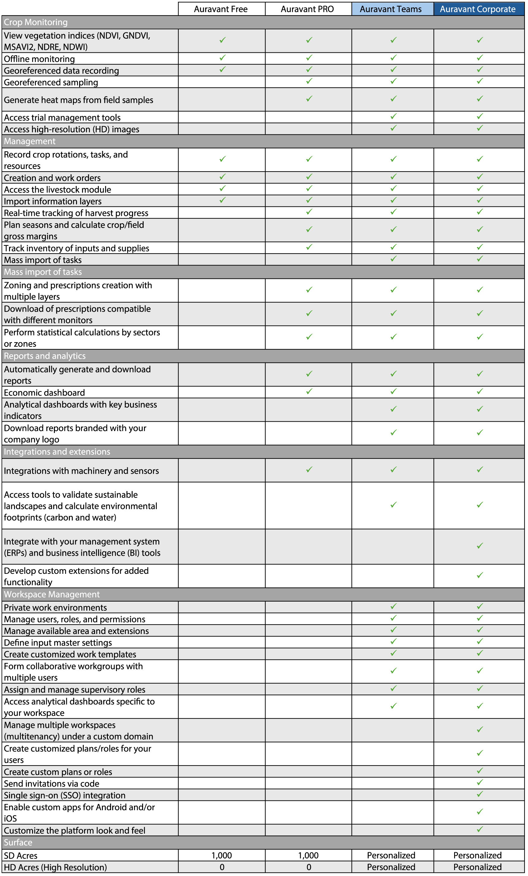
Part No. ARVFREE
Related Products


